DJI Matrice 400 · Enterprise UAV Solution
DJI Matrice 400 Enterprise Drone Platform
Matrice 400 is an enterprise-grade UAV platform designed for emergency response, power line inspection, public safety, mapping, traffic inspection, maritime operations, and infrastructure missions. It combines long endurance, high payload capacity, wire-level obstacle sensing, enhanced transmission, intelligent flight functions, and open ecosystem support.
Core Highlights
Product Positioning
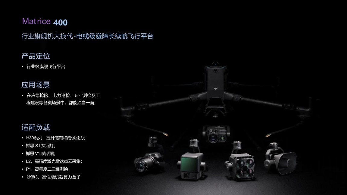
Matrice 400 is positioned as an enterprise flagship flight platform for long-endurance, high-safety and multi-scenario missions.
It is suitable for emergency rescue, power inspection, professional mapping, engineering construction, traffic monitoring, public safety patrol, maritime inspection and other demanding industrial scenarios.
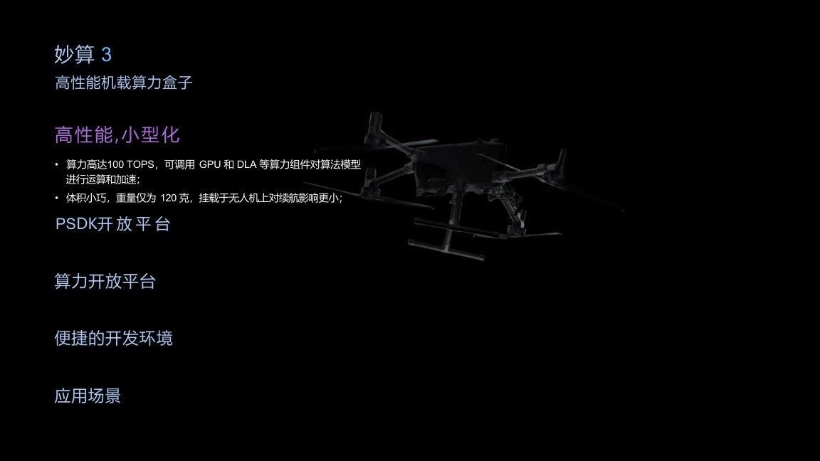
Compatible payloads and ecosystem devices include H30 series cameras, Zenmuse S1 searchlight, Zenmuse V1 speaker, L2 LiDAR, P1 mapping camera, Manifold 3 computing box and third-party payload systems.
Endurance & Payload
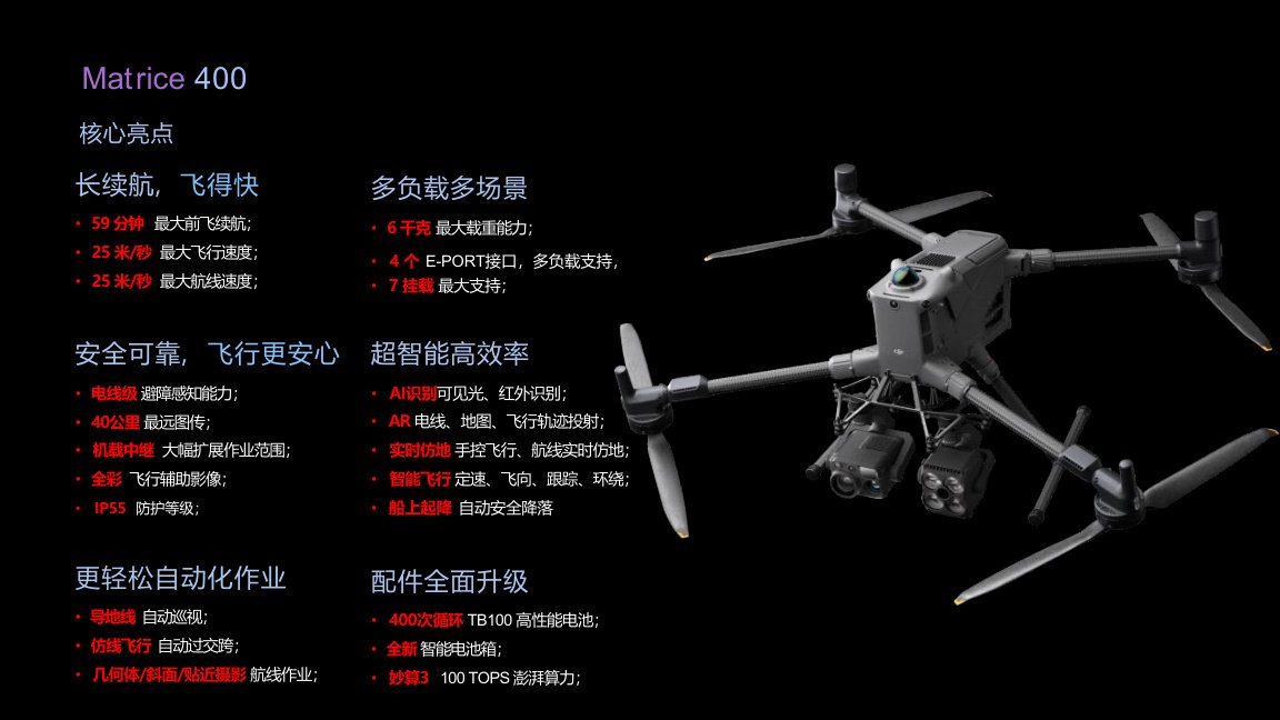
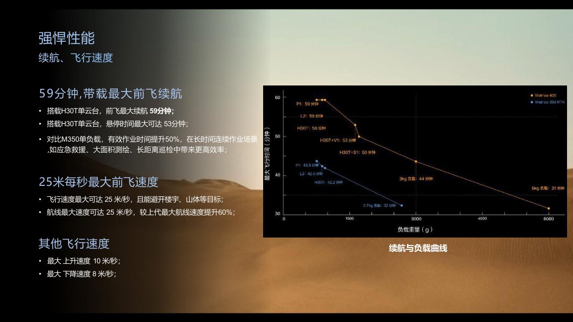
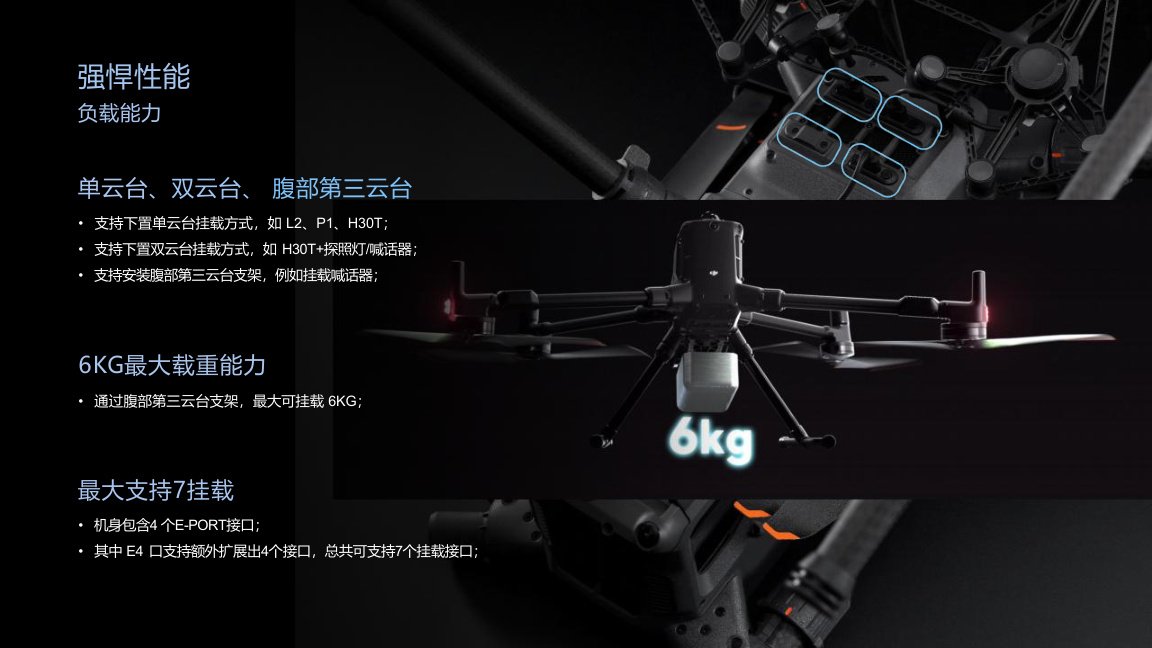
Matrice 400 supports up to 59 minutes of maximum forward flight time when carrying an H30T single gimbal payload, and up to 53 minutes of hovering time.
The platform supports a maximum payload capacity of 6 kg and multiple mounting configurations, including single gimbal, dual gimbal and third gimbal bracket options. With four E-Port interfaces and extended payload support, the platform can support up to 7 payload mounting interfaces.
Safety & Obstacle Sensing
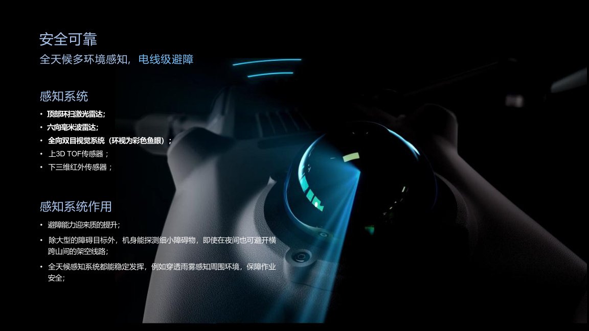
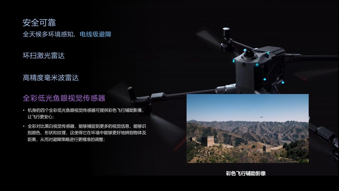
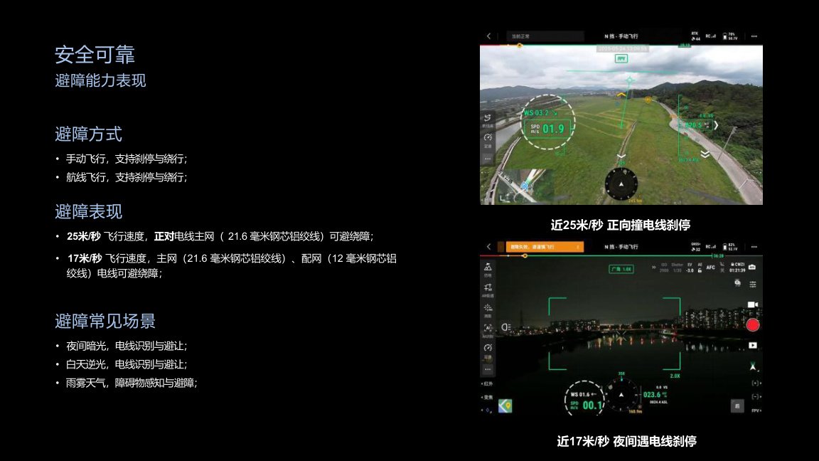
Matrice 400 integrates multi-environment sensing for safer flight in complex industrial scenarios.
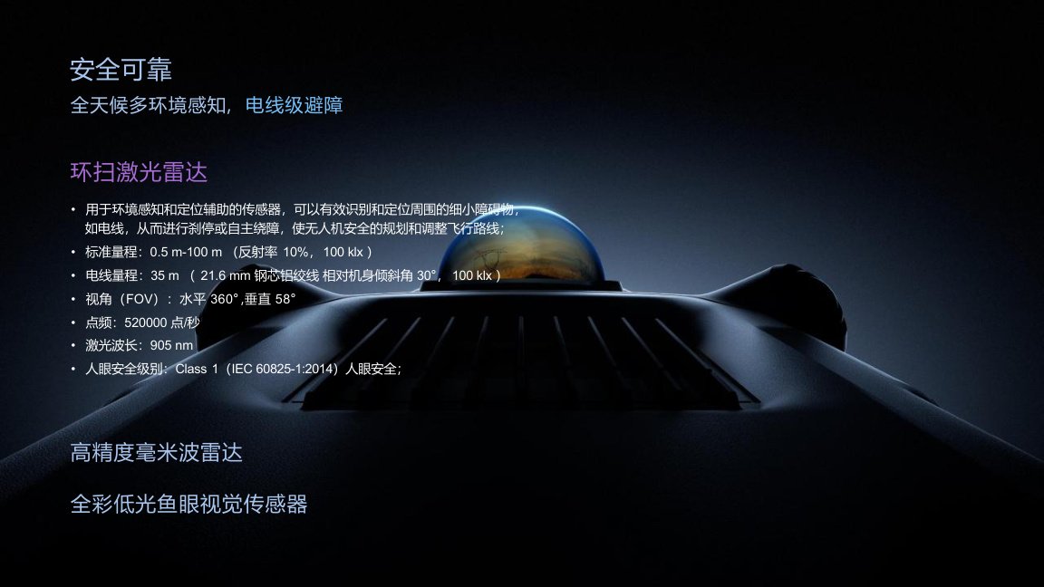
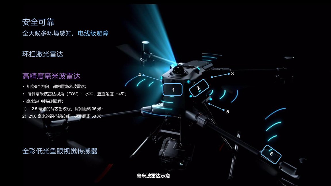
The sensing system includes a top-mounted rotating LiDAR, six-direction millimeter-wave radar, omnidirectional binocular vision with color fisheye cameras, upper 3D ToF sensor and lower 3D infrared sensor.
According to the presentation, the system is designed to detect thin obstacles such as overhead wires and support braking or obstacle avoidance in manual and route flight modes.
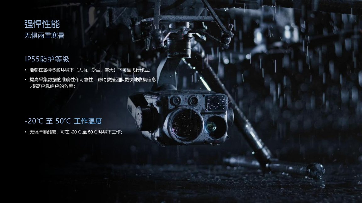
Weather Resistance
Matrice 400 has an IP55 protection rating and supports operation in harsh environmental conditions, including rain, dust, fog and challenging outdoor scenarios.
The operating temperature range is -20°C to 50°C, supporting field operations in both cold and hot environments.
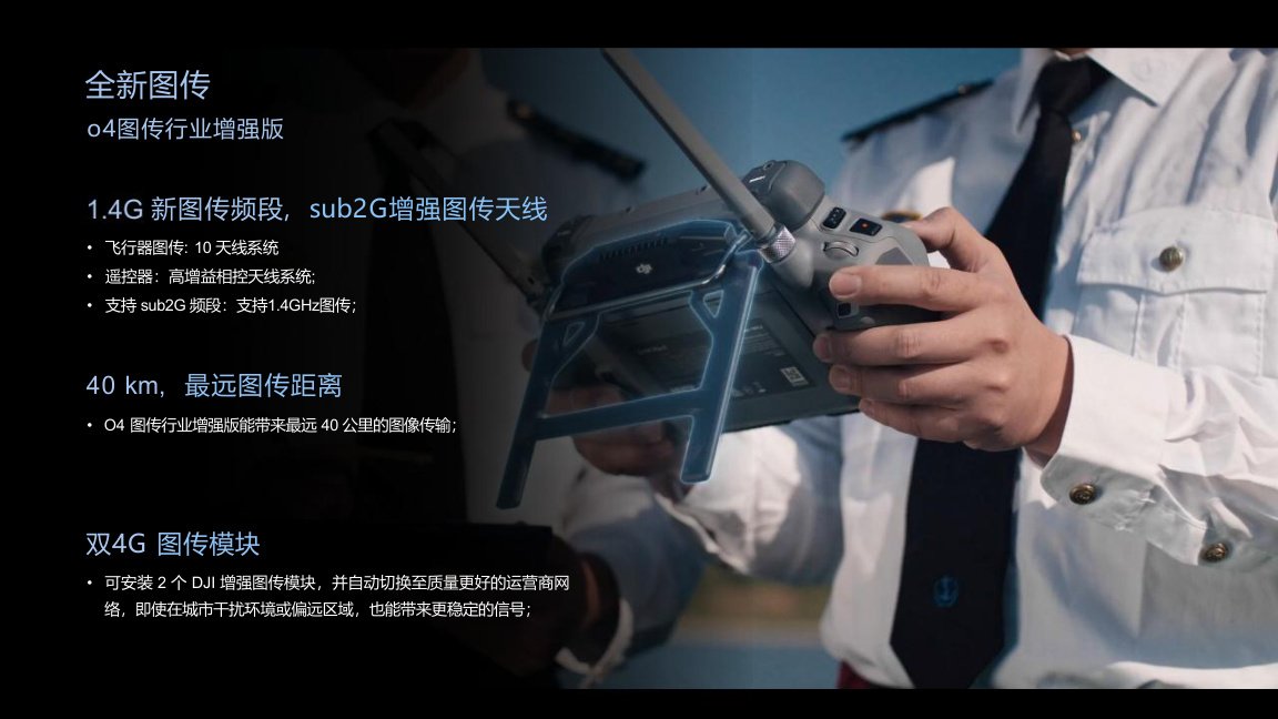
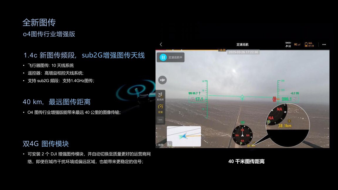
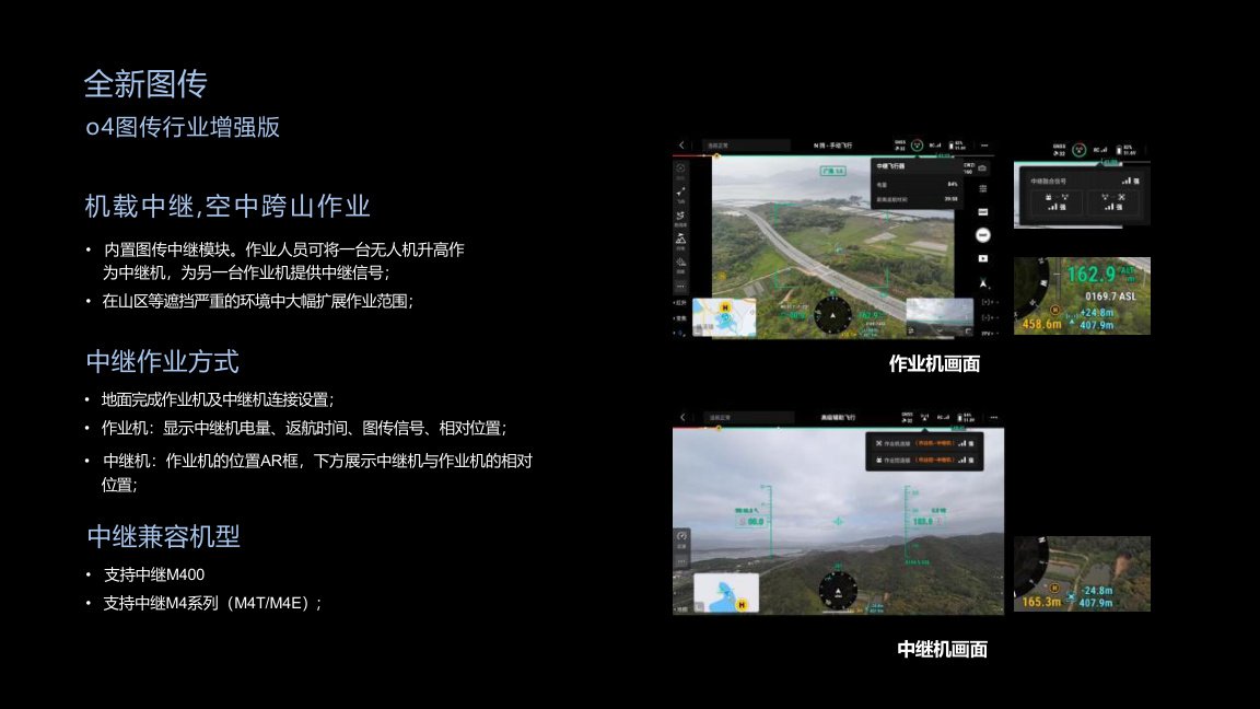
O4 Enhanced Transmission
Matrice 400 uses DJI O4 Enterprise Enhanced Transmission with new transmission frequency support, Sub-2G enhanced antenna, dual 4G transmission modules and up to 40 km maximum transmission distance.
The airborne relay function allows one drone to act as a relay aircraft for another working aircraft, helping expand operation range in mountainous or obstructed environments.

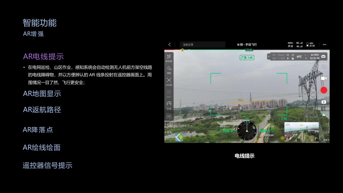
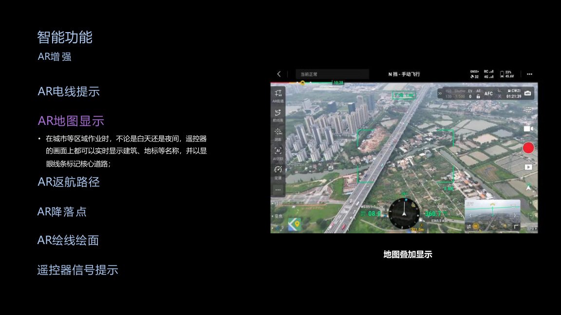
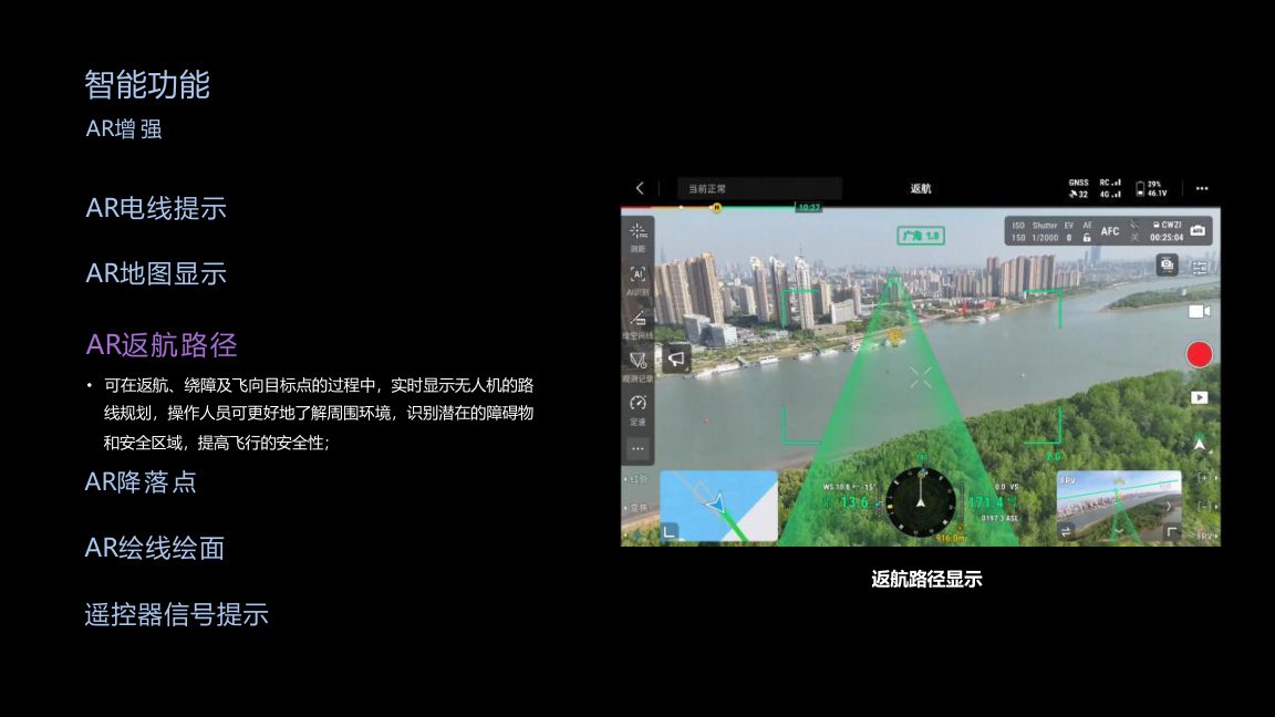
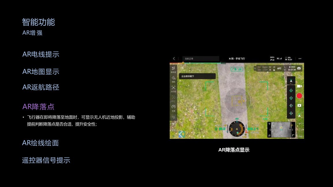
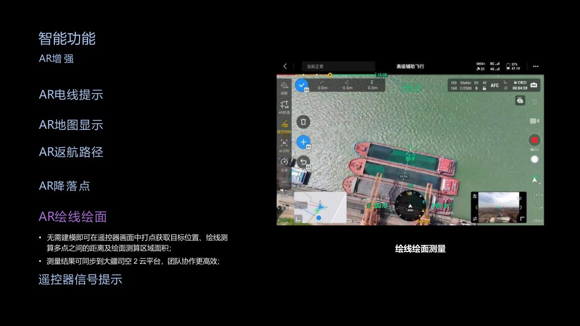
AR Enhancement
AR functions help operators understand the surrounding environment more clearly during complex missions.
Supported AR overlays include wire alerts, map display, return path, landing point projection, line and area measurement, and remote controller signal direction guidance.
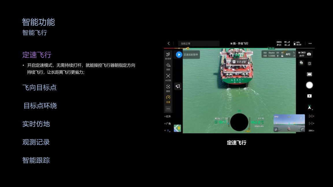
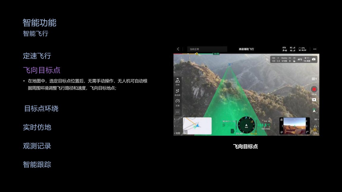
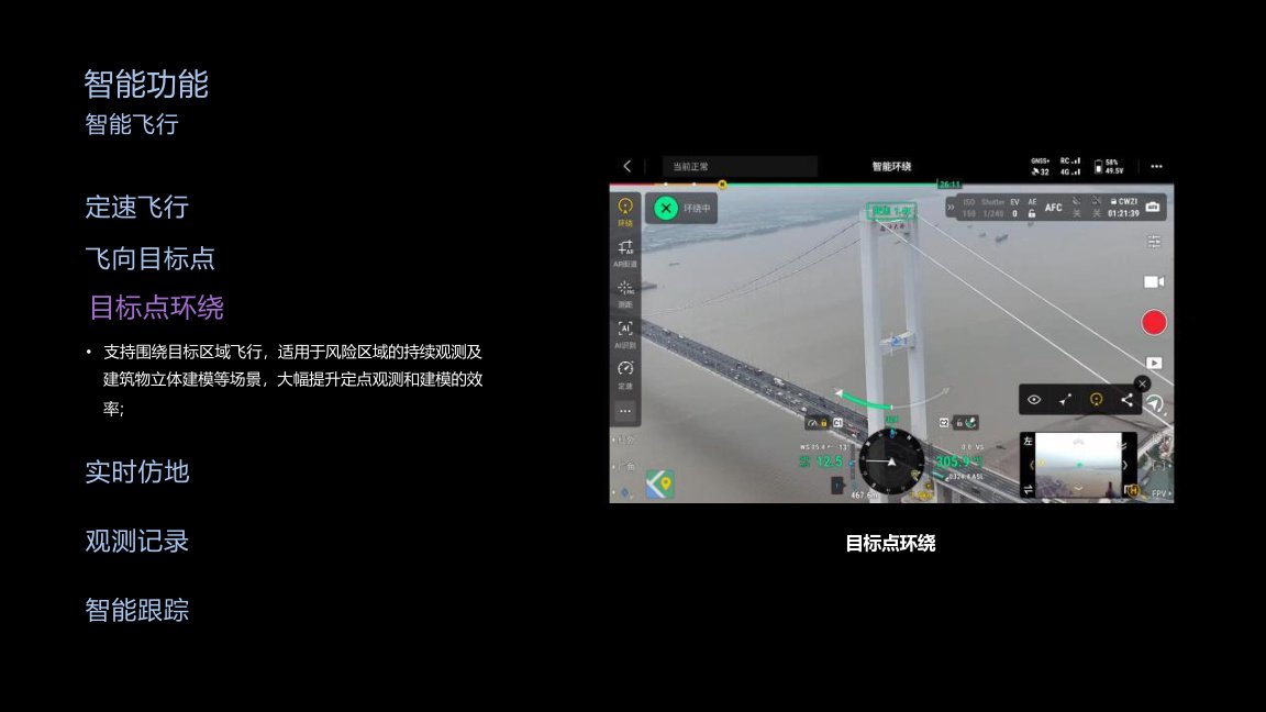
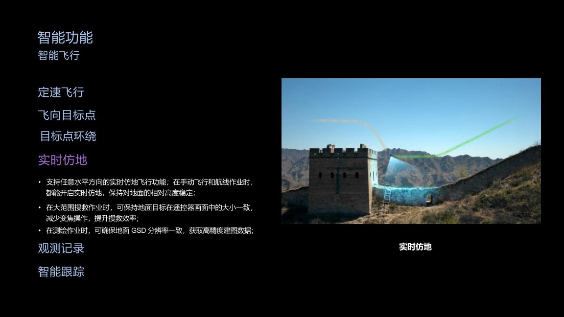
Intelligent Flight Functions
Matrice 400 supports intelligent flight functions for long-distance, repetitive and mission-critical operations.
Functions include cruise control, fly-to-target, target orbit, real-time terrain following, observation records and intelligent tracking. These tools help reduce pilot workload and improve efficiency in search, inspection and mapping scenarios.
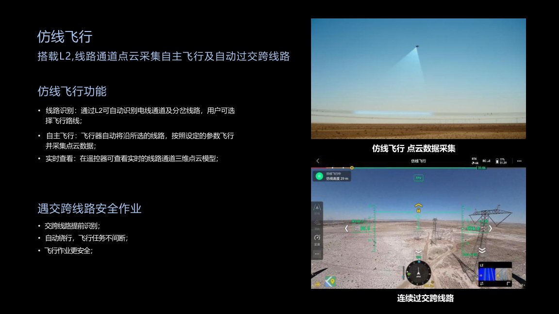
Power Line & Mapping Functions
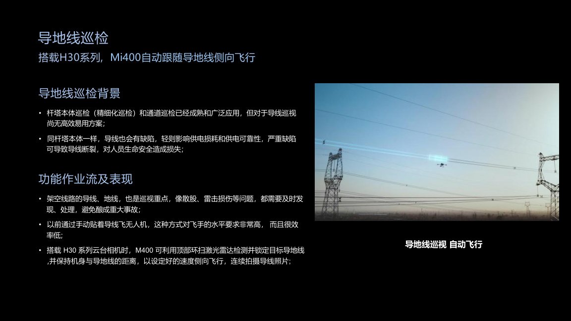
For power line inspection, Matrice 400 can work with the L2 LiDAR to support power line corridor point cloud collection, automatic line identification, autonomous flight along selected lines and automatic crossing-line handling.
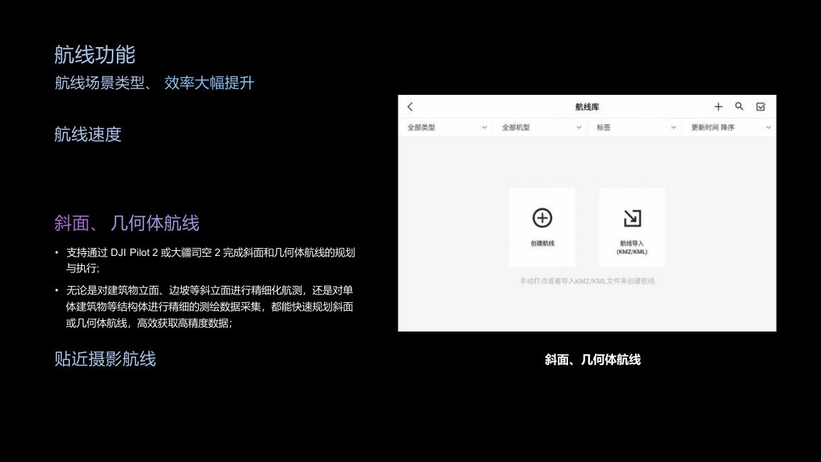
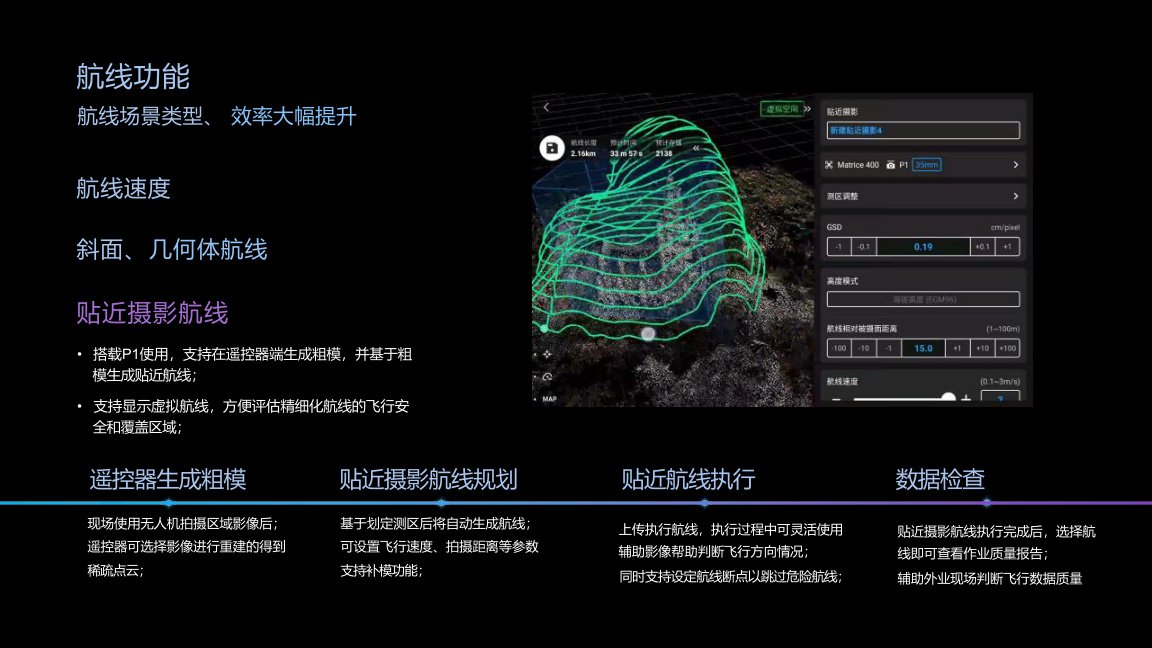
For mapping and surveying, the platform supports route operations including high-speed route flight, slope routes, geometric routes and close-range photogrammetry routes.
Ship-Based Operations
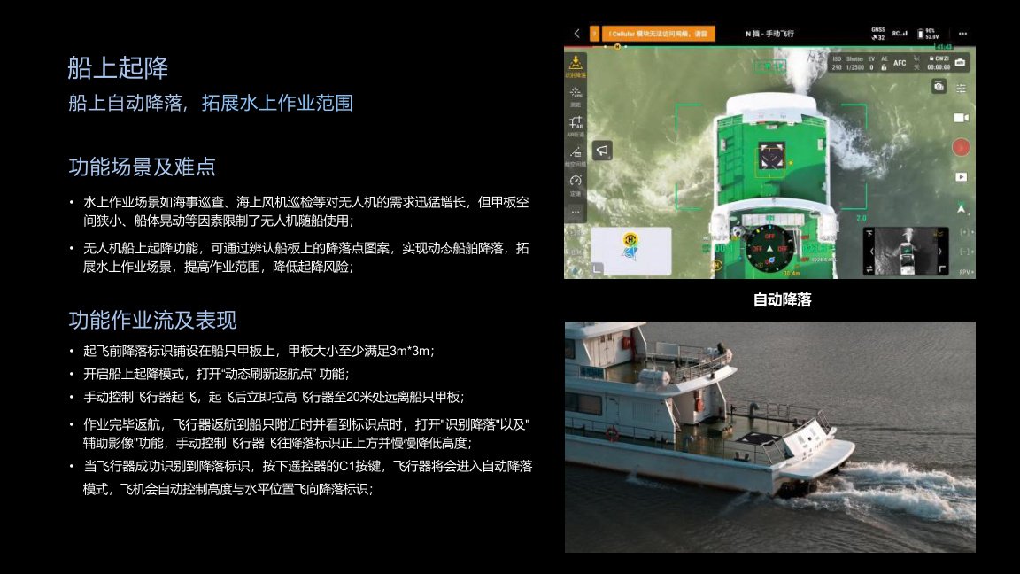
Matrice 400 supports ship-based takeoff and automatic landing scenarios. This helps expand maritime patrol, offshore wind inspection and water-based operations where deck space is limited and vessel movement increases landing risk.

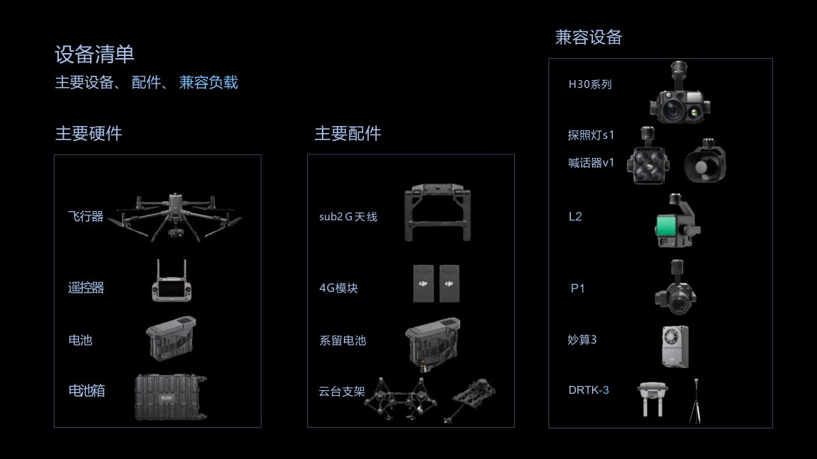
Ecosystem Hardware
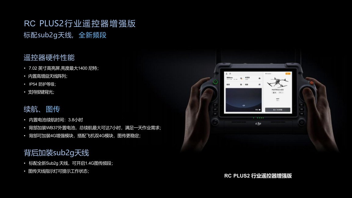
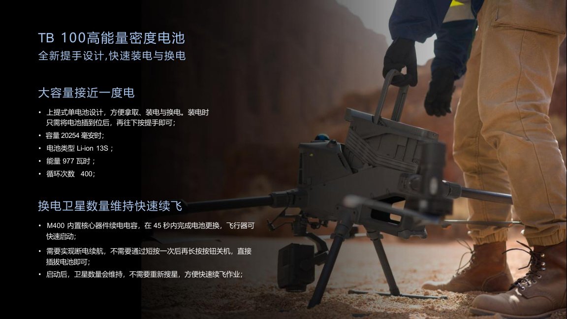
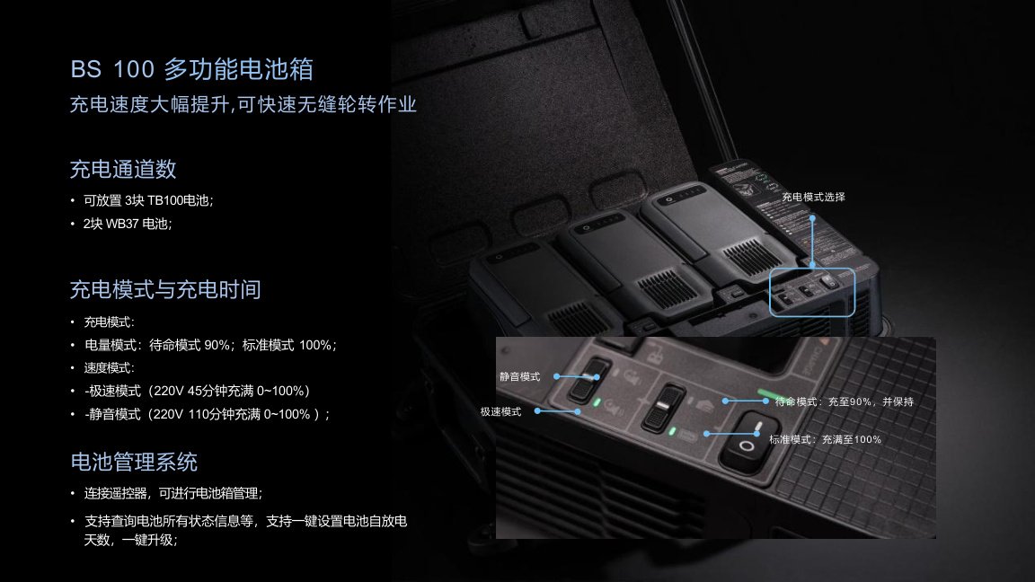
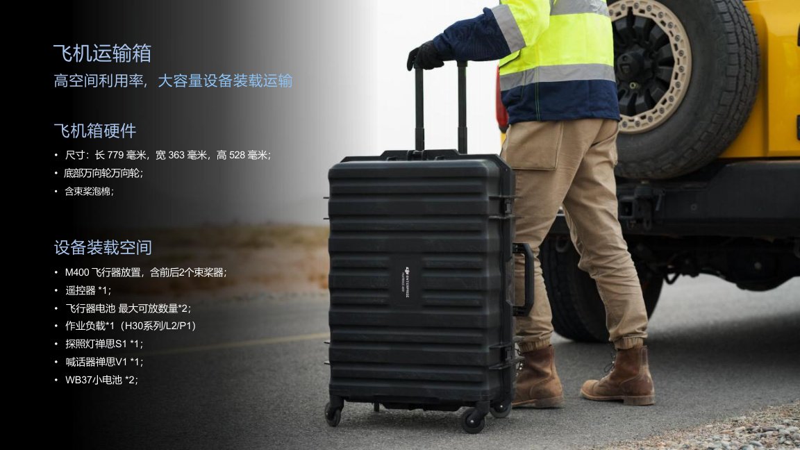
The M400 ecosystem includes RC Plus 2 Enterprise Enhanced Controller, TB100 high-density battery, BS100 multifunctional battery station, aircraft transport case, Manifold 3 computing box, H30 series payloads, Zenmuse S1 searchlight, Zenmuse V1 speaker, D-RTK 3, Sub-2G antenna, 4G modules and tethered battery ecosystem.
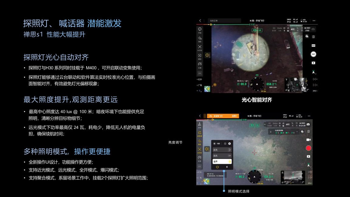
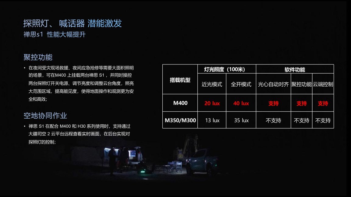
Searchlight & Speaker Module
Zenmuse S1 searchlight supports multiple lighting modes, higher brightness, beam alignment and cloud control when used with Matrice 400.
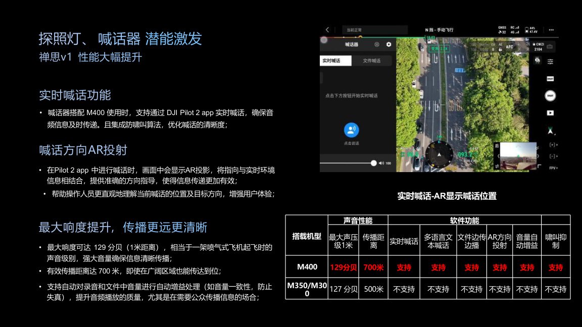
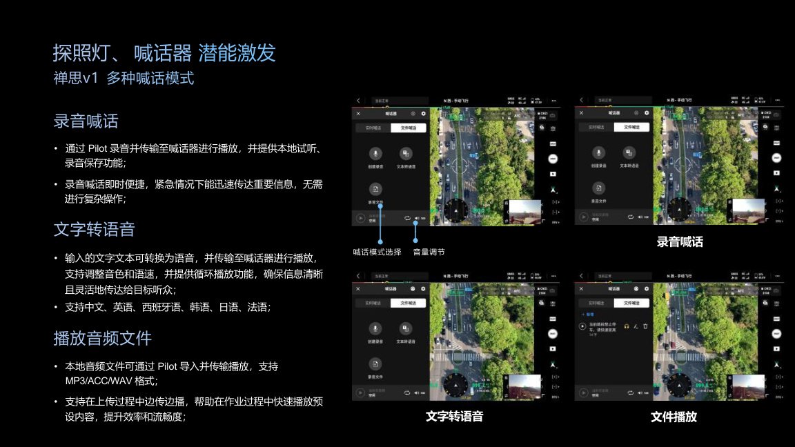
Zenmuse V1 speaker supports real-time voice broadcast, AR direction projection, text-to-speech, file playback and long-distance voice transmission for public safety, rescue and field command scenarios.
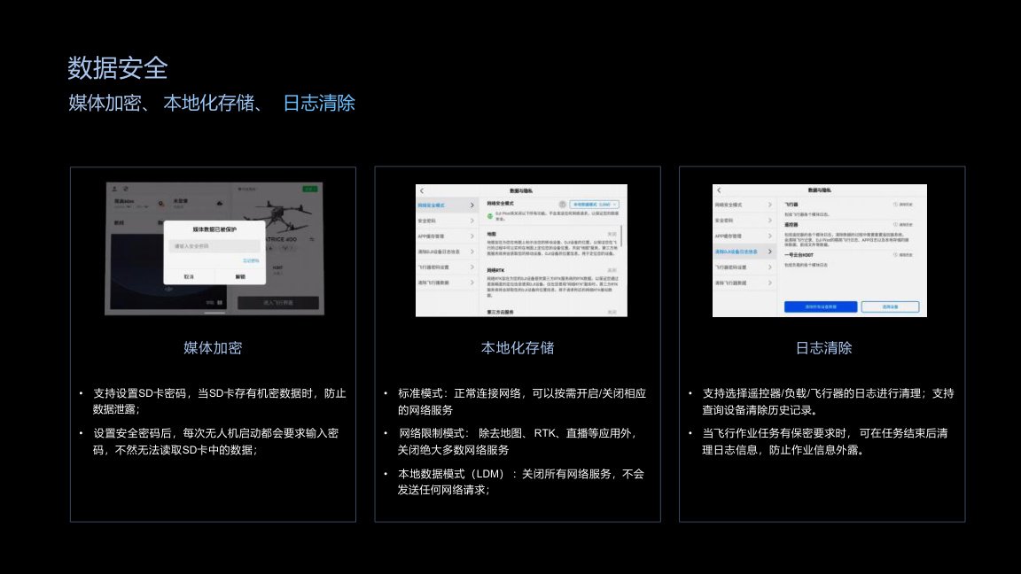
Open Ecosystem & Data Security
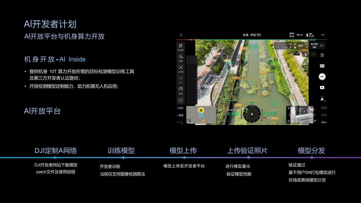
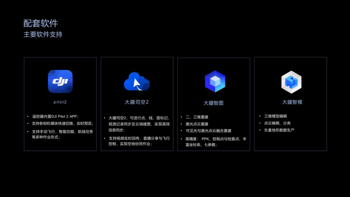
Matrice 400 supports MSDK, PSDK, cloud API integration, AI developer capabilities and third-party ecosystem solutions.
The data security section includes local data mode, network restriction mode, media encryption and log clearing, supporting sensitive inspection, emergency and government-related operations.
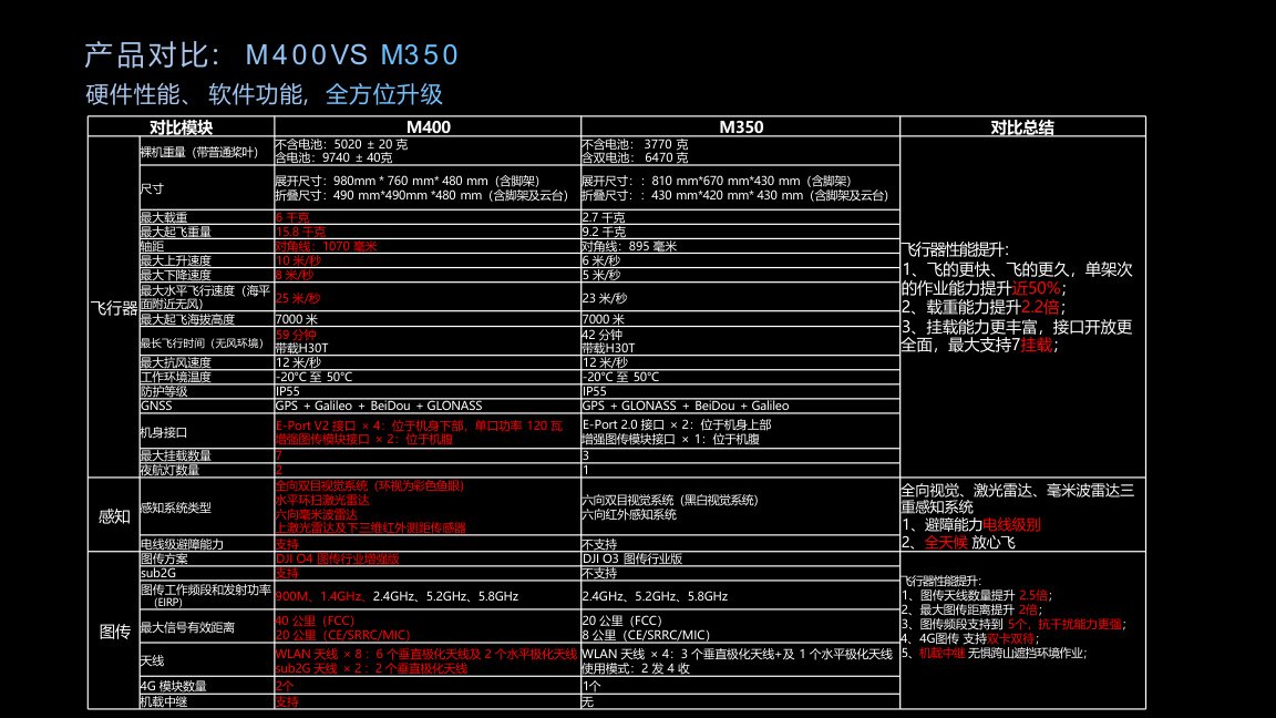
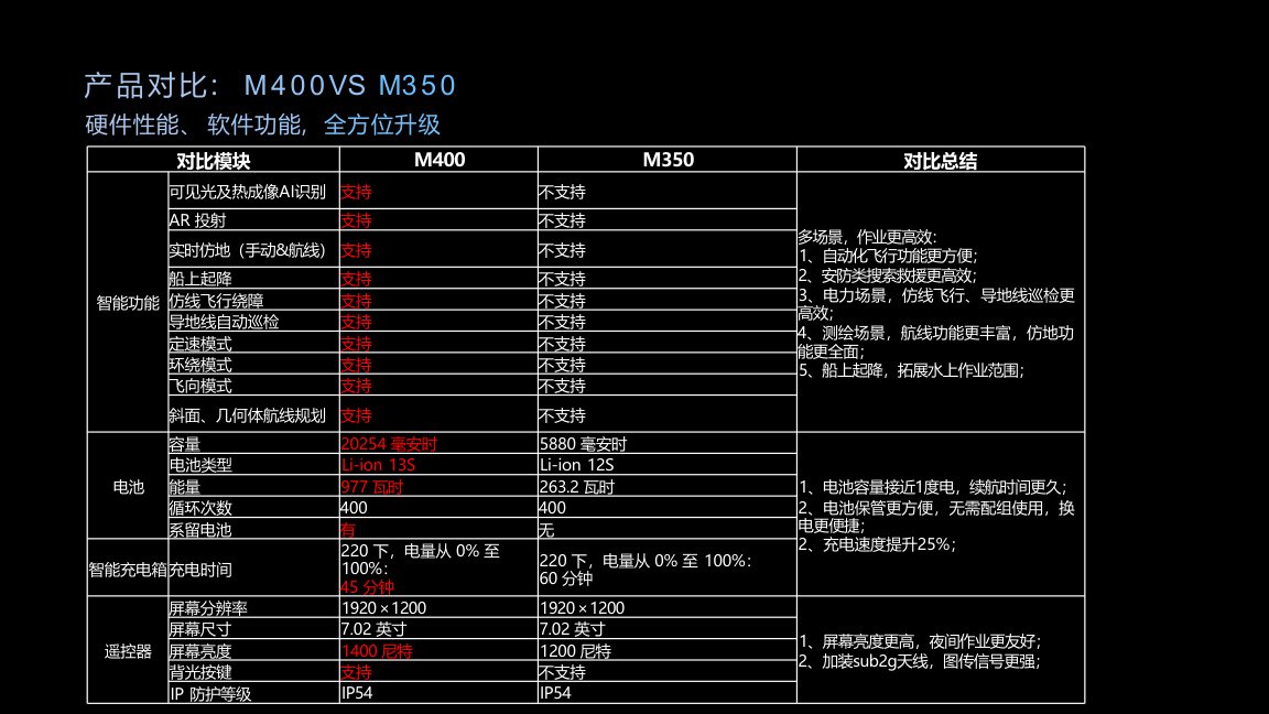
M400 vs M350 Comparison
Compared with M350, Matrice 400 improves flight endurance, payload capacity, mounting flexibility, sensing system, transmission distance, intelligent functions, battery capacity and controller experience.
The presentation highlights approximately 50% improvement in single-flight operation capability, 2.2 times payload capacity, up to 7 payload mounts, wire-level obstacle sensing, 40 km transmission and more intelligent mission functions.
Application Solution Pages
Choose an industry scenario for project quotation, payload configuration and system integration.
Drone Solution
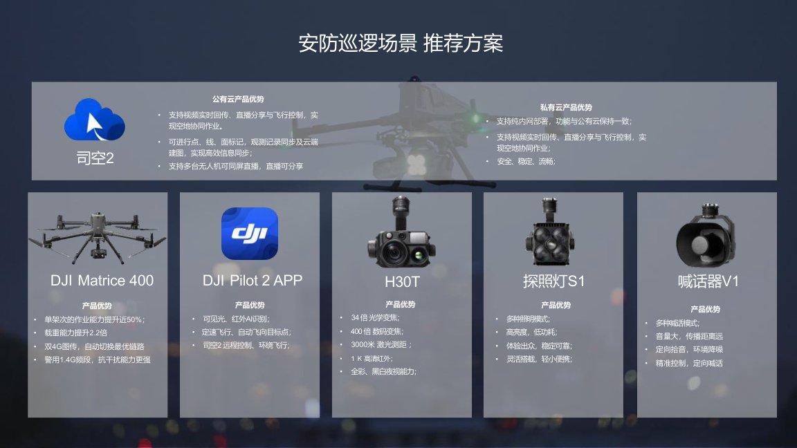
M400 Public Safety Drone Solution
M400 can support public safety patrol, night search, remote observation, AI target recognition, live video sharing, aerial lighting and voice broadcast.
Drone Solution
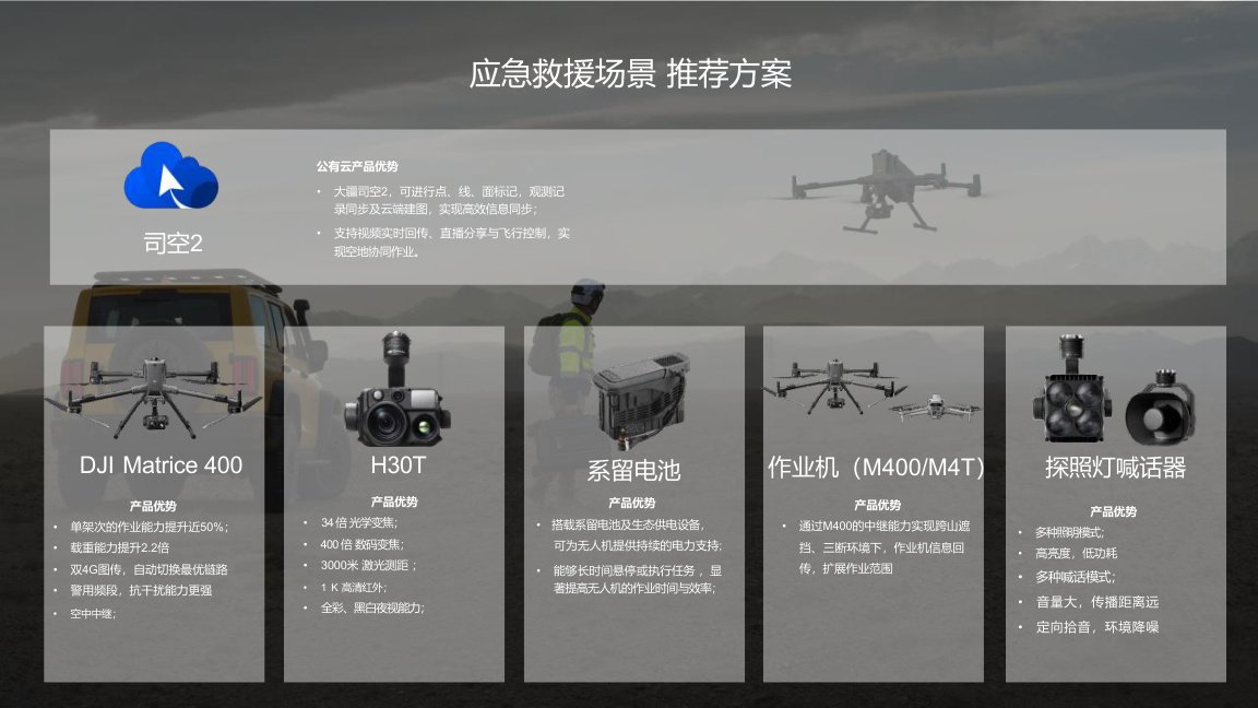
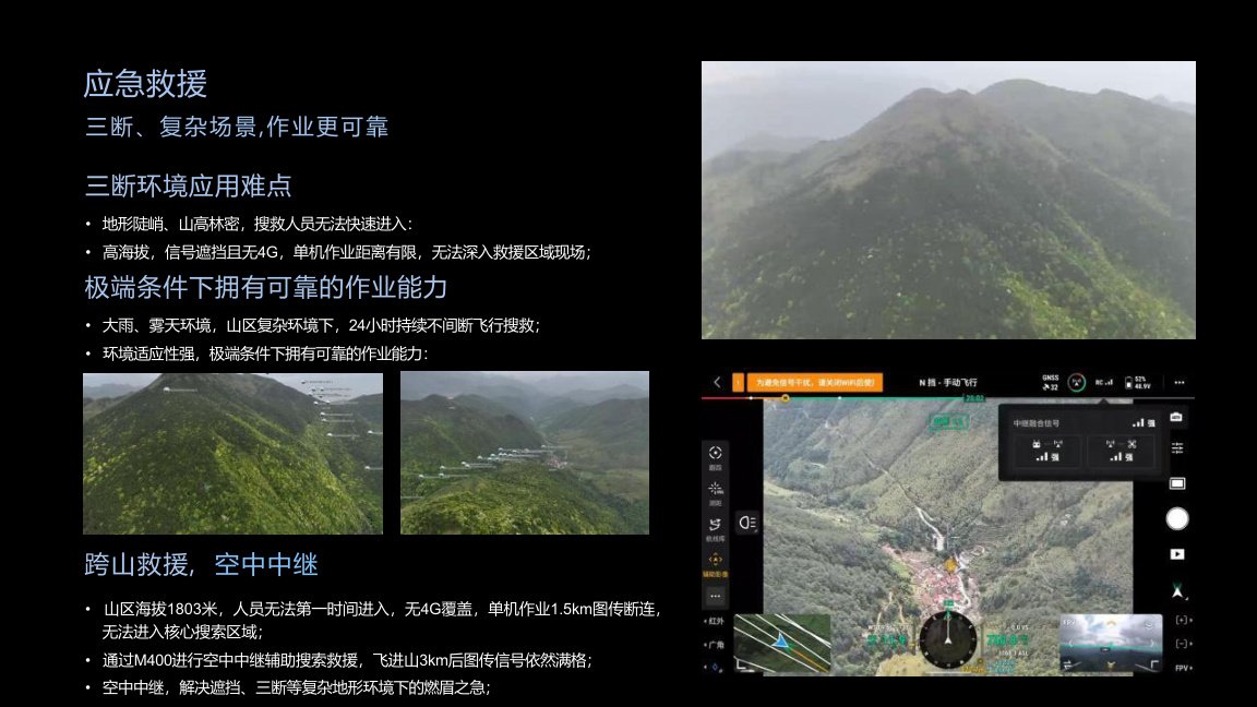
M400 Emergency Rescue Drone Solution
M400 supports emergency rescue missions with long endurance, multi-payload capability, thermal imaging, searchlight, speaker, observation records, real-time terrain following and cloud collaboration.
Drone Solution
M400 Power Line Inspection Solution
M400 supports power line inspection with wire-level obstacle sensing, AR wire alerts, L2 point cloud collection, automatic power line following, conductor and ground wire inspection and crossing-line safety operations.
Drone Solution
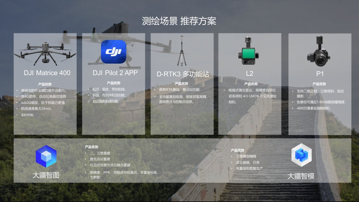
M400 Mapping & Surveying Solution
M400 supports professional mapping operations with P1, L2, high-speed route flight, slope and geometric routes, close-range photogrammetry, real-time terrain following and cloud-based data collaboration.
Drone Solution
M400 Traffic & Maritime Inspection Solution
M400 can support traffic inspection, maritime patrol, offshore wind inspection and water-based operations with long-range transmission, cloud collaboration, ship-based landing and multi-payload support.