M400 · Industry Solution
M400 Mapping & Surveying Solution
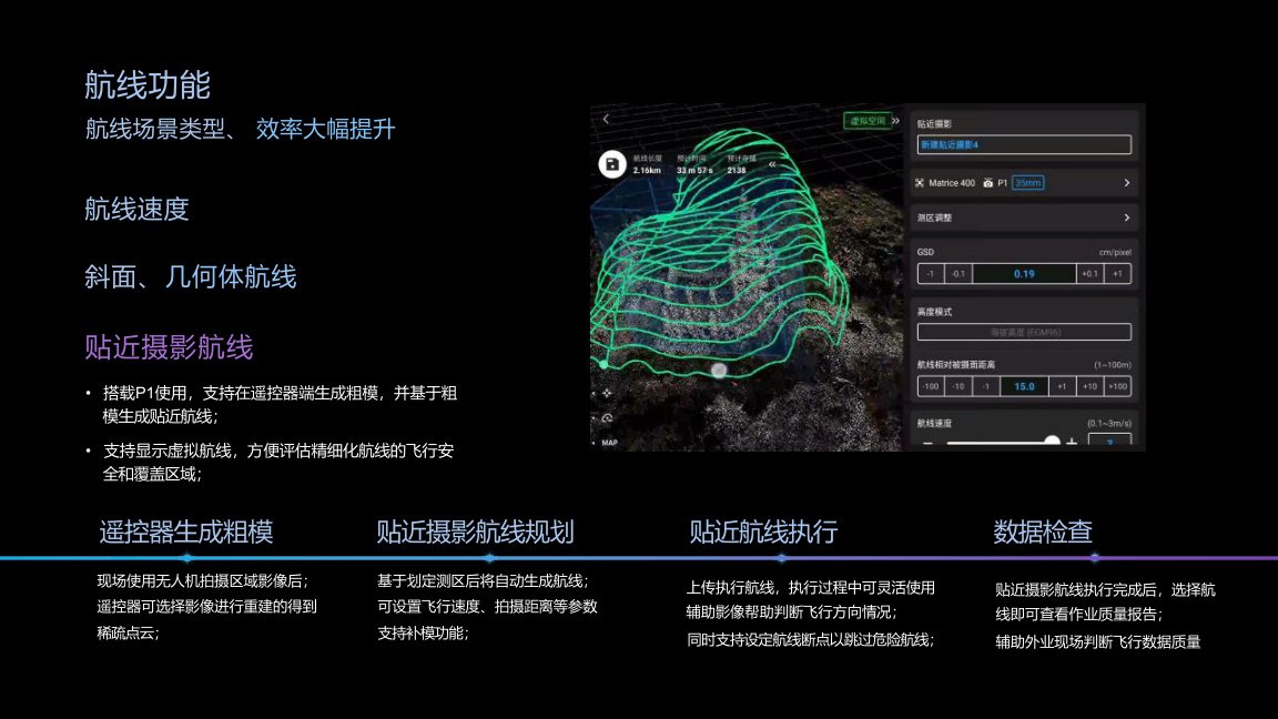
M400 supports professional mapping operations with P1, L2, high-speed route flight, slope and geometric routes, close-range photogrammetry, real-time terrain following and cloud-based data collaboration.
Application Scenario
M400 supports professional mapping operations with P1, L2, high-speed route flight, slope and geometric routes, close-range photogrammetry, real-time terrain following and cloud-based data collaboration.
Recommended Configuration
M400 aircraft
P1 mapping camera
L2 LiDAR
DJI Terra
Cloud data collaboration
Key Product Advantages
Long endurance and multi-payload configuration
Wire-level obstacle sensing and AR operation support
Long-range transmission and cloud collaboration
Industry workflow fit for government and infrastructure projects
Payload / Software Support
H30 series payloads
Zenmuse S1 searchlight
Zenmuse V1 speaker
L2 LiDAR
P1 mapping camera
Manifold 3 computing box
FlightHub 2 / DJI Pilot / DJI Terra
Project Cooperation Model
Enterprise drone procurement
Public safety drone solution
Emergency rescue system cooperation
Power line inspection solution
Mapping and surveying project solution
Traffic and maritime inspection cooperation
Regional distribution
Government project supply